


iBoat Alpha - Revolutionizing Hydrographic Surveys with Autonomous Surface ROV
Discover how EyeROV's iBoat Alpha transforms hydrographic surveys with autonomous navigation, modular payload support, and advanced marine capabilities.
Autonomous Surface Vehicles (ASVs), also referred to as Unmanned Surface Vehicles, are compact watercraft capable of both autonomous and remote operations. These vessels are primarily used for hydrographic surveying, offering a cost-efficient and eco-friendly alternative to traditional survey boats.

The EyeROV iBoat Alpha is a fully integrated autonomous system tailored for hydrographic surveys and various other applications. Its autonomous navigation capabilities streamline the otherwise labour-intensive survey process—saving time and manpower.
Key Features
Supports various payloads including:
- Single Beam Echo Sounders
- Multibeam Echo Sounders
- Side-scan Sonars
- Sub-bottom Profilers
- Water Quality Sensors
- ADCP Systems
Dual-thruster propulsion system enables advanced manoeuvrability, reaching up to 3 m/s top speed.
Built with professional-grade, watertight marine components that are easy to disassemble for transport.
Catamaran design ensures simple deployment and retrieval.
Offers both autonomous and remote control modes, enabling unmanned data acquisition.
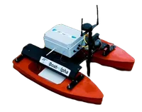
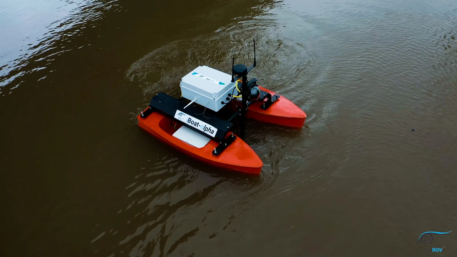
EyeROV iBoat Alpha

iBoat Alpha is a lightweight ASV built for flexibility and performance. It can carry multiple payloads like echo sounders, ADCP, and Sub-bottom profilers. The vessel is easy to manoeuvre and features an innovative two-thruster system that reaches a top speed of 3 m/s. It is made from durable, modular components that simplify transportation and on-site setup.
Single Beam Echo Sounder

This system is used for depth measurement and profiling. It consists of:
- A transducer: converts electrical energy to acoustic signals and vice versa.
- A top unit: processes and records the data.
Frequency: 500 kHz
Range: 0.3m to 100m+
Water Quality Sensors
These sensors monitor physical, chemical, and biological properties of water, such as:
- pH
- TSS
- BOD
- COD
They are critical for water resource management, scientific research, and environmental monitoring.
Side Scan SONAR
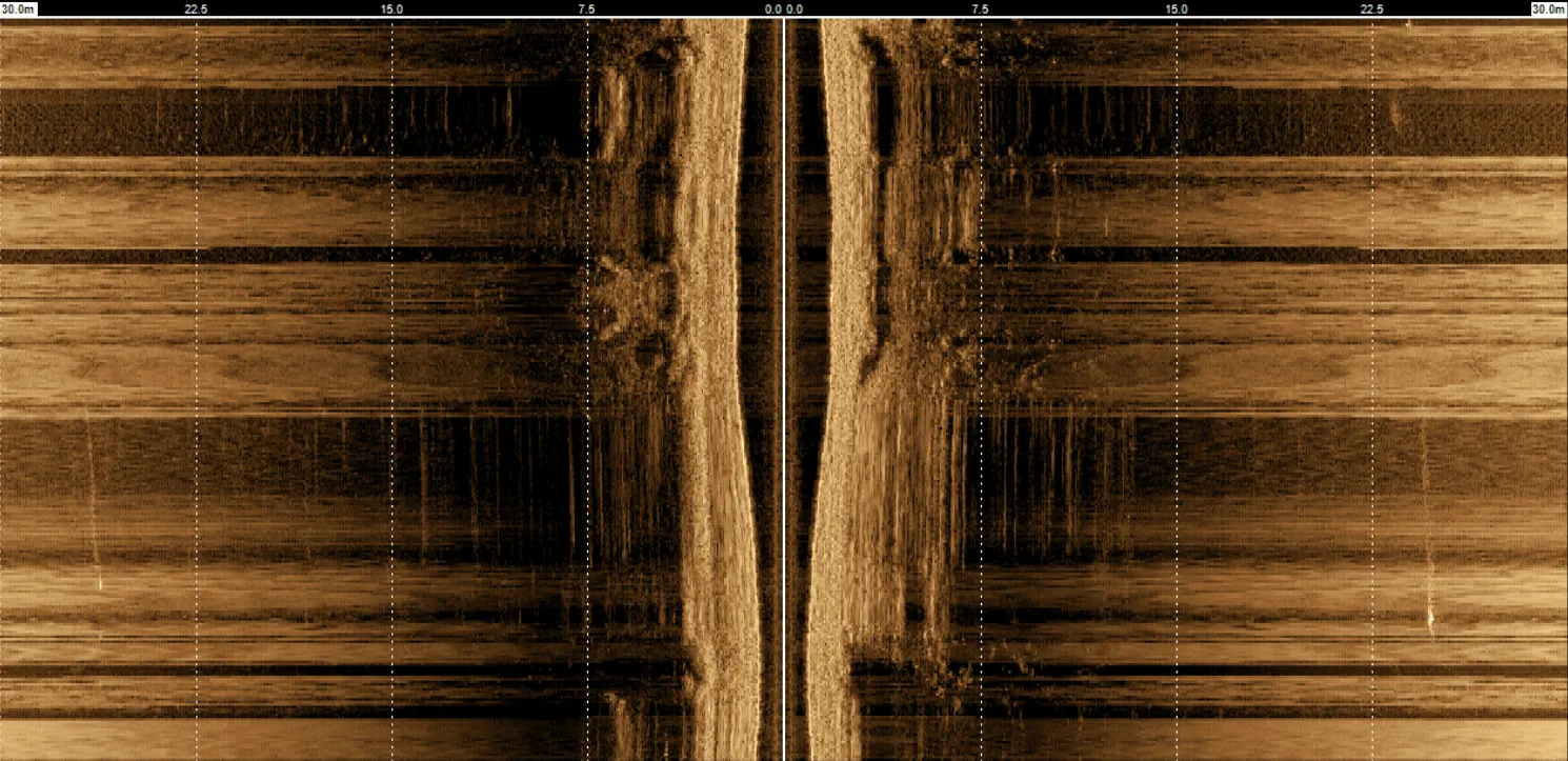
Used for mapping seafloor micro-topography and surface features.
- Emits fan-shaped pulses directed at a wide angle from the sensor.
- Captures detailed acoustic images of the seabed.
Operating Frequency: 452 kHz
DGPS - Differential GPS
DGPS enhances the accuracy of standard GPS by correcting position discrepancies, ensuring precise navigation.
RTK GPS
The onboard RTK GPS system is validated using known reference points, approved by the client. This improves positional accuracy during survey operations.
Survey Methodology Using iBoat Alpha
- RTK DGPS will be checked at mobilization on-site or at port.
- Navigation data is logged using a dedicated survey package.
- Grid spacing maintained as per client requirements for bathymetry.
- Survey lines are pre-loaded for accurate and consistent data collection.
At mobilization:
- The Party Commander and Surveyors will verify geodetic variables.
- Echo sounder data is recorded along with position, heading, depth, and fixed marks.
- Bathymetric results are compiled into a chart.
- Tide gauge data is tied to the nearest vertical reference point to determine Chart Datum.
- BM (Benchmark) is used to compute tide gauge height relative to the local reference.
Each step is carefully validated before survey commencement to ensure accuracy and reliability.
Learn More about EyeROV iBoat Alpha.